Types of Land Survey and Their Use
Types of Land Survey and Their Use
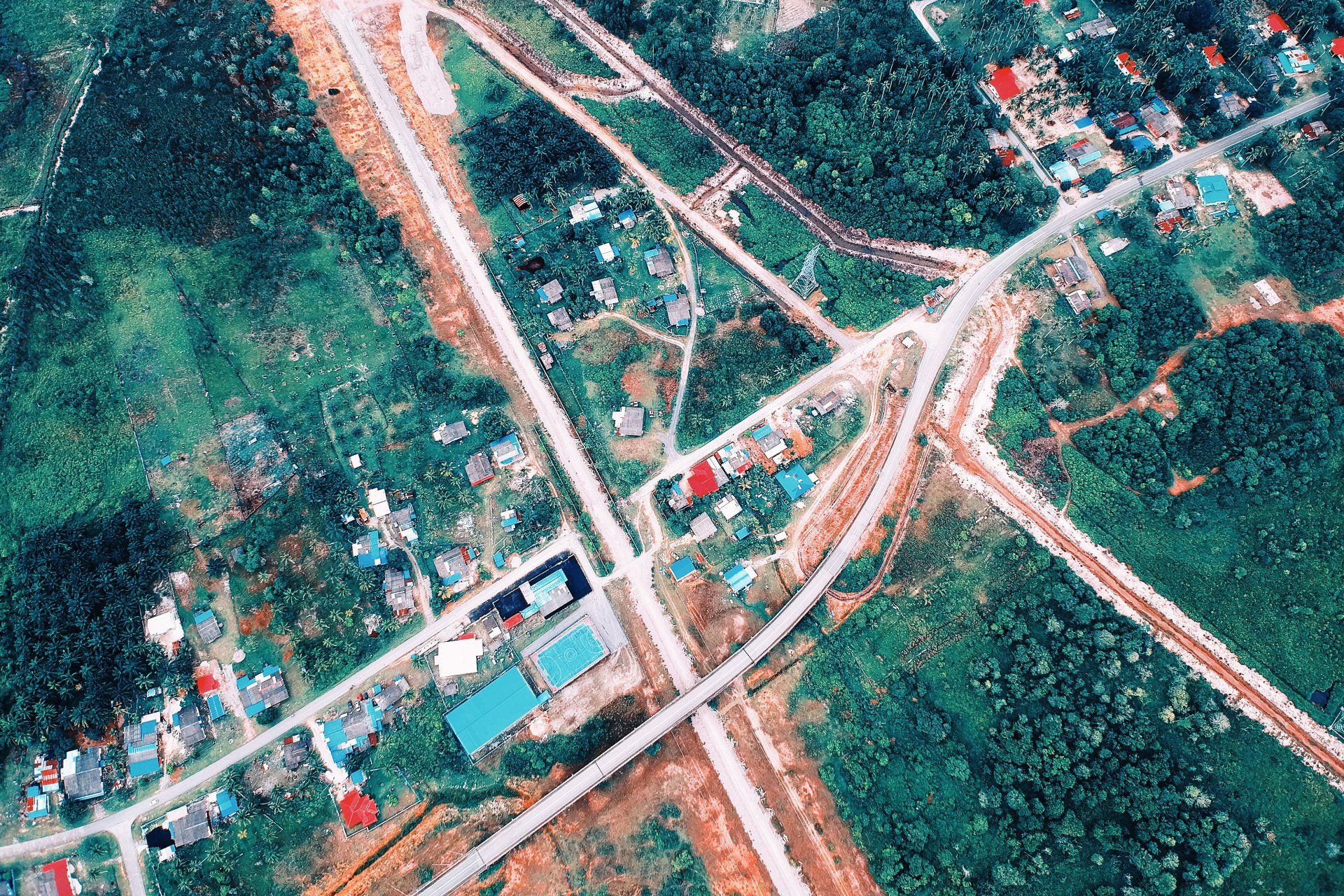
A land survey is necessary before any construction can be started. It will allow you to measure the topography and angle, determine the location of existing infrastructure, and establish the boundaries and slope of your structure.
What is Land Surveying?
Land surveying involves gathering information about the land by making observations, field measurements, or using different instruments. Data analysis is used to plan, design, and establish property boundaries.
A surveyor is a person or a team that is responsible for carrying out the survey. They are responsible for identifying, verifying, and documenting the boundaries of properties.
Land surveyors use field equipment to make measurements and take photographs to support their findings. Software solutions were also used to create plans and measures.
Satellites play a major role in land surveying. They provide higher accuracy and allow for greater precision. It doesn't matter if you're building a residential, commercial, or recreational property.
Boundary Survey
Boundary surveys are used to determine the boundaries of the property as described in deed documents. It indicates where the property ends and begins. A boundary survey is sufficient for basic information about your property.
Boundary surveys are essential for all types of property, commercial or residential. This type of survey is used to settle disputes between neighbours or to sell or buy properties.
This includes information about the extent of easement and encroachments and the property's restriction as per local or state regulations.
Topographic Survey
Topographic surveys are focused on the land's geographical characteristics. This includes all data about the elevation points, contour lines, and slopes.
This site is intended to provide all information about the natural and man-made features of the lands.
Construction Survey
All construction projects require construction surveys, regardless of whether they are for roads, bridges, buildings, or roads.
This will identify all land features that could affect the construction. The surveyor will determine the points that could be used as markers to guide the construction of the new structure during the survey.
This survey shows the layout of utility lines, large building sites, networks of streets, and their positions. It also shows the alignment of roads and highways.
A construction survey is essential for any project because they directly impact the timeline, design features, resource allocation, budget, and other factors.
Contour Survey
Contouring is the process of determining the elevations of different points on the ground and fixing points at the same horizontal location in the contour map.
This map can be used to identify any significant elevation change in the land. It shows the valley, slope, steepness, and hill.
A contour survey is done at the beginning of engineering projects such as a canal, railway or building, dam, and many others.
Layout and Demarcation Survey
Construction Layout Survey refers to the measurement taken to control elevation, horizontal location, dimensions, and configuration prior to or during construction. Demarkation refers to the process of locating or planning construction boundaries on the ground.
Ready to work with Vancouver Land Surveyor Pros?
Let's connect! We’re here to help.
Send us a message and we’ll be in touch.
Or give us a call today at 604-200-4103
Land Surveyor Vancouver Quote
More Marketing Tips, Tricks & Tools